GIS & Mapping
A geographic information system (GIS) is a computer system for capturing, storing, checking, and displaying data related to positions on Earth’s surface. GIS can show many different kinds of data on one map, such as streets, buildings, and vegetation. This enables people to more easily see, analyze, and understand patterns and relationships. A GIS combines spatial data and attribute data (usually in tabular format). The attribute data is defined as additional data about the spatial features and the combination of these two data types makes GIS a very effective tool for problem solving.
GIS has various applications such as mapping the location of real-world features and the visualization of the relationships between them. Density mapping is also a common application of GIS whereby points or lines concentration in a given area are shown for instance, the concentration of dumping sites within a municipality. GIS is used to determine what is happening within an area of interest by using tools provided by the system for instance determining socioeconomic characteristics of people within a certain defined ‘noise pollution’ area of interest.
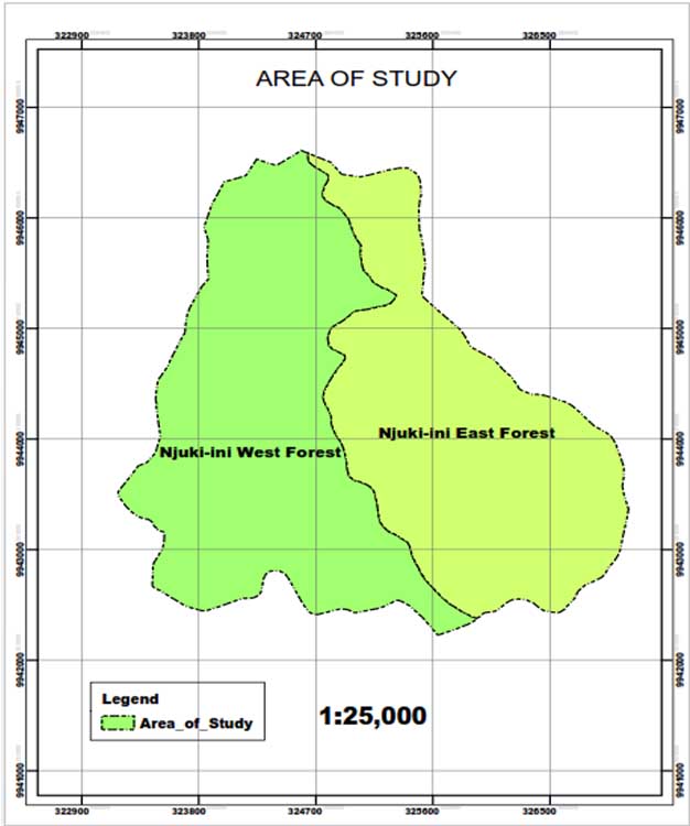
The end products of GIS are land use maps, proximity maps, street maps, urban maps, Digital Terrain Models, Digital Elevation Models and custom maps that meet the requirements of the client.
Our surveyors pride in the use of state-of-the-art GIS software and data collection tools that enable us to deliver on time, accurate and reliable GIS products.